


The Virtual event will be returning in 2022, with more details to be released in April 2022

Virtual Six Summits ran between 1st & 31st May 2021, and there was a badge!
We hope you enjoyed the challenge and even with the plan of the in-person event in 2022, the virtual event could be returning…

This Years Event
Unfortunately, this year our epic leader Mark won’t be walking the Six Summits on his treadmill, but we have put six new challenges together for you to have a go at. This can be completed with your Scout Troop or Explorer Unit virtually or together at your meetings.
Complete this year’s event, and you can earn the limited edition Virtual Six Summits badge. On completion, get your leaders to submit the evidence, and you can order them delivered at £2 each (min 5).
NOTE: Badges can only be ordered and sent to either Scout Leader, Unit Leader or Group Scout Leader with a minimum order of 5 badges.
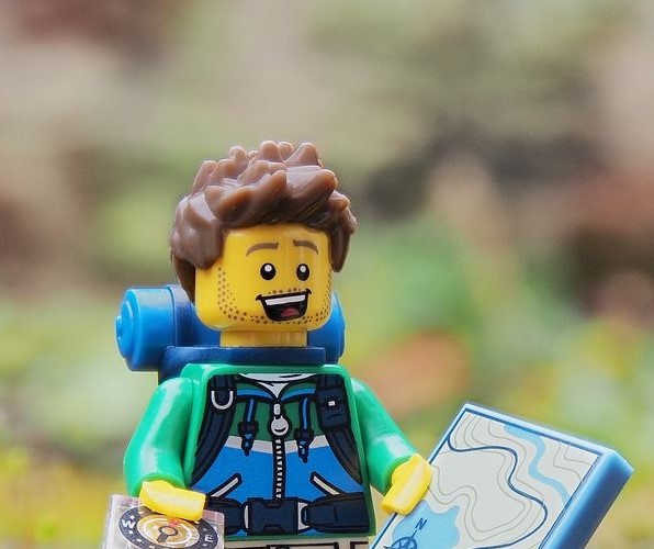
Challenge 1 – Hike
Challenge 2 – Meal
Challenge 3 – Climb
Challenge 4 – Contours
Challenge 5 – Camp
Challenge 6 – Maps
Information for Leaders
Challenge 1
Go on a hike

With your Scout Troop, Explorer Unit, family, or friends, go on a 10km walk.
Before your walk, you should carry out a kit check, so you are prepared for your hike. What do you think you need for a walkout on the hills?
Here are a few items to get you started
- Rucksack
- Waterproof coat and trousers
- Water
- Snacks to eat while walking
- What else is on your list?…

We have an example in the photo, why not create your own kit list photo?
Challenge 2
Cook a meal

Using only one pan, cook a meal on a camp stove, BBQ, or a fire.
This is excellent practice for when you are on your expeditions! How creative can you be?
Meal Ideas
- One-Pot Rice
- One-Pot Pasta
- Silver Turtles
Please take a picture of your cooking, maybe share it with us on social media.
How practical are your recipes for Six Summits weekend if you had to carry all your food?
Challenge 3
Climb Corndon
Climb the height of Corndon, and we have two options for you.
Corndon is the very first of our summits, and it’s a climb right from the start. Corndon is 513 meters above sea level with normal assent of 163 meters from Six Summits start.
Option One
Option one is our standard challenge to climb the distance from start to summit, 163 meters.
This works out for a house with 13 stairs going up and back down a total of 66 times. You can only walk, no running, please, start your stopwatch, and how long does it take you?
Option Two
The Ultimate challenge, to climb from sea level to the summit. For this, you need to go up and back down a total of 207 times, with the same rules, walk only, no running and start your stopwatch and record your total time.


Challenge 4
Food Contour

Can you make your own 3D model of a hill?
We are looking for your own 3D edible contour map. Some suggestions for what to make it out of include:
- Cut out toast, and use jam or any other spread to hold it together.
- Make sponge cake and build it up with layers.
- Do you have another idea? We look forward to seeing your creations.
You can shape it on a hill nearby to you or look at our artistic outline from one of the summits we would normally be walking.
Challenge 5
Camp one night at home

Camp for one night.
We may not be able to go to campsites, but we can find somewhere that is not our own beds. So get out of your bed and get creative!
For one night:
- Build a shelter
- Sleep in the garden in a tent
- Put up a hammock
- Make your own shelter in the garden
- Build a den in the house.
How creative can you be?
Challenge 6
All about maps
Using the map provided in the download to complete the following tasks and question. You will need to print the map out, or you could work on screen. Only use the coloured area of the map and not the frosted area around the outside.
Easy
- How many Phone boxes can you see on the map?
- What type of Church is at Hope Bowdler 475924?
- The Jack Mytton Way crosses this map. What is the total distance of the Way in km?
- What does the map symbol ” >> ” mean when it’s on a road (401916)
Medium
- Give a six-figure grid reference for the Mast (SE of Church Stretton) on Hazler Hill?
- What is the distance as the crow fly’s between the car park at Pole Bank (413937) and the Train Station in Church Stretton (455936)?
- How many FB (Foot Bridges) can you find marked on the Map?
Challenging
- From the lowest point marked with a spot height to the highest point marked on the map, what is the difference in height?
- Count the number of times you see the word “farm” on the map and add it to the number of times you see the word “hill”?
- In km’s what is the shortest distance you could walk between the centre of Chelmick (467914) and Pole Cottage (413938)?

Click on the map image to download the full map.

Completed?
Once completed, all the challenges, send your evidence to your Scout Troop or Explorer Unit leader to verify.
Your leader needs to
- Complete our online completion form.
- Scout Group to pay £2 per badge (min 5), plus post & packaging.
- Pay for badges through our payment system.
We will send the badges after 31st May along with your certificates.
Information for Leaders, including registration and completion forms.


